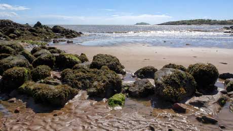
Picture 1 - Rockcliffe, 6 miles from Dalbeattie, in Scotland's Dumfries and Galloway is part of a National Scenic Area and has been a picturesque seaside resort since Victorian times. Parts of Rockcliffe, in particular much of the land immediately to the north, are owned by the National Trust for Scotland. The crescent shaped sandy bay is punctuated by craggy rocks and rock pools. The village of Rockcliffe overlooks Rough Island, a bird sanctuary owned by the Scottish National Trust that can be reached via a causeway at low tide, except May and June to protect nesting birds. Visitors planning a trip to the island must check the tide tables beforehand to avoid being caught out by the tide. The coastal path from Rockcliffe to Sandyhills is reputed to be one of the finest cliff walks in Britain, with stunning views across the Solway to Cumbria and the Isle of Man and nesting seabirds such as fulmar, razorbills and cormorant in spring and summer.
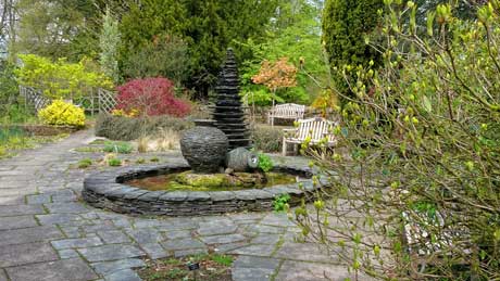
Picture 2 - Threave Garden and Estate is managed by the National Trust for Scotland and is located near Castle Douglas in Dumfries and Galloway. The gardens are part of the 1,500 acres (607 ha) Threave Estate that was developed by William Gordon who bought the estate in 1867. The garden is home to the Practical School of Horticulture and is the only Scottish garden dedicated to the training of horticulturists. The gardens include a working walled garden, a rock garden, several ponds and water features and is a haven for wildlife, with an osprey platform and Scotland's only bat reserve. There are eight species of bats and a dedicated conservation programme to protect them. The wider estate is managed as a nature reserve that includes part of the Loch Ken and River Dee Marshes Special Protection Area. Threave Castle is located on an island in the River Dee, at the north-west side of the estate. Although managed by National Trust for Scotland, admission is also free for other National Trust members on production of a membership card.
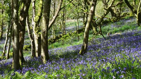
Picture 3 - Native bluebells near Caulkerbush, in Dumfries and Galloway. Bluebells arnative to north west Europe, but have been introduced elsewhere. They are bulbous, violet-blue, perennial plants of woodland and hedgerow, and prefer a light, usually acid soil. The woodland variety has 'nodding bells' and is more delicate and darker blue than the common garden bluebells. Those are the much more vigorous 'Spanish interlopers', with upright flowers. The bluebell's Latin name is hyacinthoides non-scipta, hence the hyacinth fragrance of these beautiful flowers. Dumfries and Galloway is located in south west Scotland. It is the mildest region in Scotland, is warmed by the Gulf Stream and has miles of quiet sandy beaches and coastal cliffs. The area includes the Galloway Forest that extends to three hundred square miles and is famed for mountain biking, walking trails and its abundance of wildlife. There is little light pollution, which led to the country's first Dark Skies Park.
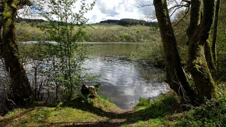
Picture 4 - Loch Arthur, close to the delightfully named village of Beeswing in Dumfries and Galloway. This is a beautiful part of lowland Scotland, with an undulating coastline of rocky shoreline and sandy beaches, whilst inland, there are acres of forest and green spaces. The village of Beeswing was formerly known as Lochend, in reference to its position near Loch Arthur, which lies to the east of the village. The loch has been claimed as the setting for the Arthurian story of the Lady of the Lake. The village was renamed from Lochend to Beeswing to honour the famous racing mare, Beeswing, a 19th-century British Thoroughbred racehorse (1833–1854) from the north of England. In her day, Beeswing was hailed as the greatest mare in Britain and one of the greatest of all time.
Our only holiday in 2020 - A four day break in North Ayrshire at the end of
September, with glorious blue skies, stunning scenery and quiet beaches with wonderful views of the
Isle of Arran.
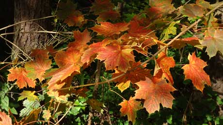
Picture 1 - Eglinton Country Park is close to the town of Kilwinning, in North
Ayrshire. The park is located in the grounds of the old Eglinton Castle estate and covers an area
of 900 acres, of which 98 acres are woodland. In the early 1900s the estate had one of the foremost
collection of significant trees in the whole of southern Scotland. Tree removal for sale as timber
was one of the first acts of the new owners of the estate when it was sold in the late 1940s. The
Country Park is now managed and maintained by North Ayrshire Council and its Ranger Service.
Admission is free to all.
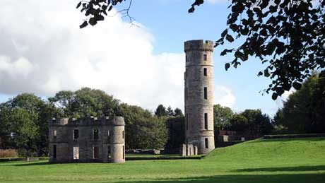
Picture 2 - Eglinton Castle was the ancient seat of the Earls of Eglinton and is
located just south of the town of Kilwinning in North Ayrshire. The current castle was built
between 1797 and 1802 on the site of a 16th-century stronghold. The immense cost of upkeep, the
poor condition of the castle and death duties took their toll on the family finances and the castle
was abandoned in 1925. It was de-roofed in 1926 and became progressively ruinous. The building
finally came to an undignified end during the Second World War when it was seriously damaged during
army training held there. All that survives is the single corner tower and some low walls. In the
1970s plans were made to open the extensive grounds (988 acres) around the ruins to the public.
Eglinton Country Park is now fully established with free entry and is one of the most popular
visitor attractions in Ayrshire.
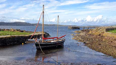
Picture 3 - Portencross North Harbour in North Ayrshire. The narrow B7048 ends in
the village, which consists of a tiny collection of cottages, two harbours, a castle, a pier
(visible in the background) and a free car park. The coastal views are superb and take in the
island of Great Cumbrae to the north, Little Cumbrae and Bute to the north west, and the Isle of
Arran to the west. The picture is of North Harbour, the Old Harbour being even smaller; merely a
small tidal inlet next to the castle, built circa 1360. In 1955 the castle became a scheduled
ancient monument. The concrete pier in the background was the second concrete pier to be built in
the world. It was constructed to facilitate the transport of locally harvested potatoes, which were
carried to Glasgow by paddle steamer. The pier was also used for a period by Clyde steamers to
bring day trippers to the area, as the railway, proposed in 1899 never materialised.
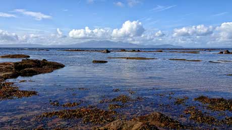
Picture 4 - Boydston Shore, also known as North Beach or North Shore, is a sandy
beach that lies between Ardrossan and Seamill in North Ayrshire and has glorious views of the Isle
of Arran. Ardrossan is a seaside destination and is popular with day-trippers who come to enjoy the
sandy beaches, backed by sand dunes. The beach is adjacent to the Ayrshire Coastal Path (ACP) that
runs from Glenapp to Skelmorlie, a walk of 100 miles along one of the finest panoramic coastlines
in the British Isles. There is a superb backdrop of the ever-changing profile of the mountains of
Arran across the Firth of Clyde. Just off shore is the low lying Horse Island, site of many
shipwrecks, with its prominent stone beacon erected in 1812. The island is a nature reserve and an
important breeding site for eider ducks, herring gulls and lesser black backed gulls.
'Staying local' at Whitworth, Rossendale, our home town - These four
photographs were all taken on a walk round our local area, all within a few hundred yards of our
home at Whitworth, a former Lancashire cotton mill town, within the South Pennines Heritage
Area.
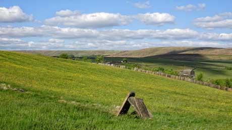
Picture 1 - Much of the moorland is wild and extensive. Rossendale has more public
footpaths within its boundary than any other borough in the country and mountain bike magazines
class the South Pennines as having some of the best riding in the country.
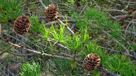
Picture 2 - Tree planting schemes are encouraging birds and wildlife to return to
the area, and hiding the former landscape scars caused by excessive stone quarrying. Cowm Reservoir
is a popular walk for local people along the levelled footpath that now encompasses the reservoir,
owned by United Utilities.
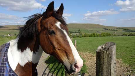
Picture 3 - In the far distance is Brown Wardle hill, a local landmark. The 47
mile long Rossendale Way crosses over the summit of Brown Wardle Hill and the Pennine Bridleway
(including the 42 mile long Mary Towneley Loop) attracts many horse riders.
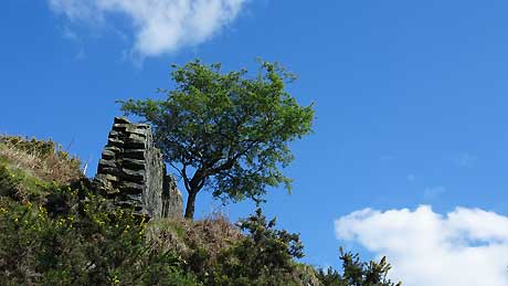
Picture 4 - 'Lone tree' above Cowm Reservoir. Whitworth's water supply originally
came from Cowm Reservoir until it became polluted in the 1970s. The former reservoir now provides
water ski facilities and there are extensive tree planting schemes, including a Life for a Life
Memorial Forest at Cowm Reservoir.
Trent & Mersey Canal & the River Weaver
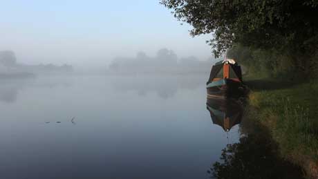
Picture 1 - Sunrise at Whatcroft Flash, between Middlewich and Anderton on the
Trent & Mersey Canal. Oakwood Marina is now on the opposite bank to the towpath. It opened in
August 2018. Within less than a mile are Park Farm Marina (opened 2016) and Orchard Marina, an
established marina that opened in 1989.
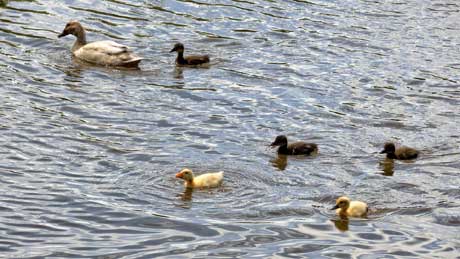
Picture 2 - Ducklings at Broken Cross, Rudheath, on the Trent and Mersey Canal -
Cheshire. The small village has a canalside pub called The Old Broken Cross. There is some mooring
space for boaters who want to stop and have a meal or a drink, pending on when the current
coronavirus situation ends and life gets back to normal.
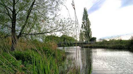
Picture 3 - The River Weaver was originally used for the transportation of salt
and was completed in 1732. Navigation runs from Winsford Bridge to Weston Marsh Lock where there
are clear views of the River Mersey below. The navigation is 20 miles long with five locks, all
manned. Canal boats can access the River Weaver via the Anderton Boat Lift, near Northwich. The
boat lift is one of the 'Seven Wonders of the Waterways.
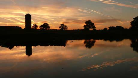
Picture 4 - Sunset at Whatcroft Flash on the Trent & Mersey Canal. The T&M
was the country's first long-distance canal and was built by James Brindley to link the River Trent
to the River Mersey. The canal opened in 1777 and runs for 93.5 miles, from the River Trent
navigation at Derwent Mouth to Preston Brook in Cheshire, where it meets the Bridgewater Canal.
Wallington is a National Trust owned country house and gardens located near the village of Cambo and about 12 miles from Morpeth in Northumberland. Wallington was bought in 1688 by Sir William Blackett, a wealthy Newcastle family of mine owners and shipping magnates. They purchased Wallington as a country retreat from the family's main home at Anderson Place in Newcastle. It is said that Sir William's son and heir employed six men simply to carry him and his drunken guests to bed after their grand parties. When the son died, he left debts of £77,000 and an illegitimate daughter, Elizabeth Ord. Wallington then passed to his nephew Walter Calverley on condition that Walter married the illegitimate Elizabeth and adopted the Blackett family name. Sir Walter Calverley Blackett had the house and gardens completely redesigned. The noted landscape gardener Lancelot 'Capability' Brown, born just two miles away from Wallington and educated at Cambo School, was involved in the recreation of Wallington. The estate and farms were donated to the National Trust in 1942. There are 100 acres of rolling parkland, ornamental lakes, lawns, and a recently refurbished walled garden.
The Holy Island of Lindisfarne is off the
coast of Northumberland, mid way between Bamburgh and
Berwick-upon-Tweed and about 60 miles up the coast from
Newcastle-upon-Tyne. The island is 2.7 miles long by 1.3 miles
wide. For 2 or 3 hours either side of high tide the causeway
that links the island to the mainland is submerged beneath the
North Sea and, if you are fortunate to be on the island during
high tide, as we were, this enchanting island is almost your
own! Lindisfarne, to give it its shorter name, is steeped in
history, with a monastery founded by St. Aidan that dates back
to AD635. It also has a 12th century Priory that was, in Anglo
Saxon times, the epicentre of Christianity as well as being the
home of St Oswald. Lindisfarne is also known as Holy Island. It
remains a place of pilgrimage today and is the final destination
of one of Scotland’s great walking trails, the St. Cuthbert’s
Way.
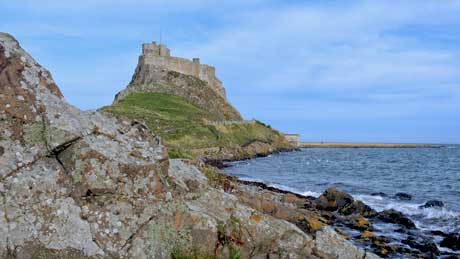
Picture 1 - Lindisfarne Castle is located on
Beblowe Crag, the highest point on the island. This part of
Northumberland was once a very volatile border area between
England and Scotland and in addition it was frequently attacked
by Vikings. The castle first appeared in about 1550, around the
time that Lindisfarne Priory went out of use and stones from the
priory were used as building material. For the next three
hundred years, the fort (as it was known then) was home to
temporary garrisons of soldiers on detachment from the larger
force based at nearby Berwick. The castle, garden and nearby
lime kilns have been in the care of the National Trust since
1944 and are open to visitors.
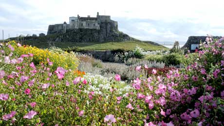
Picture 2 - The walled garden (now known as
Gertrude Jekyll's Garden) was first constructed here by troops
manning Lindisfarne Castle, maybe as far back as the 1500s or
1600s with the aim of growing vegetables to supplement their
diet. In 1902 the Country Life magazine founder and owner Edward
Hudson took out a lease from the Crown on Lindisfarne Castle and
commissioned his friend, the architect Edwin Lutyens, to
transform a Tudor artillery fort into a holiday home in which
Hudson could entertain during his summer visits. In 1911 Hudson
decided to restore the old walled garden to use as a place to
enjoy. Lutyens brought in his regular collaborator, Gertrude
Jekyll to undertake the design work. The garden later fell into
disuse, but in 2003 it was restored to Gertrude Jekyll's
original design by the National Trust.
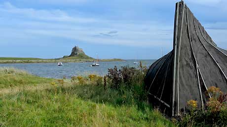
Picture 3 - Lindisfarne boat sheds are made
from upside down fishing boats, a tradition that goes back to
the early 1900s. The fishermen created storage sheds for their
nets and other equipment by turning over their old herring
boats. These were once common a common sight in the north east
of England but Lindisfarne is one of the few places where these
sheds still survive. Many of the boats are covered in tar to
make them waterproof. Two of the three sheds on the castle
grounds were burnt down in 2005 but were soon rebuilt by the
National Trust and are open to the public.
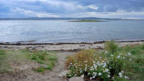
Picture 4 - The view of St. Cuthbert's Island
(formerly called Hobthrush Island) from Lindisfarne. It is
connected to Lindisfarne at low tide in the same way that
Lindisfarne is connected to the mainland. You can walk across to
it, although it becomes an island at high tide. It was here, on
this island, that St. Cuthbert first attempted to live as a
hermit but it was still too close to Lindisfarne. He moved to
Inner Farne for solitude, where he lived for 12 years and died.
Inner Farne is now a National Trust protected island and is home
to breeding puffins, guillemots, Arctic terns and many other
species of sea birds.
Cumbria is a generally rural area in north
west England. The county came into existence in 1974 after the
passage of the Local Government Act 1972. Its county town is
Carlisle and the only other major urban area in Cumbria is
Barrow-in-Furness, once a significant producer of naval vessels.
Barrow-in-Furness has built all but three of the Royal Navy's
nuclear submarines, including the latest class of fleet
submarines, currently under construction by BAE Systems
Submarine Solutions at Barrow's Devonshire Dock Hall.
Cumbria is the third largest county in England by area, yet is
one of the most sparsely populated counties in the United
Kingdom.
The county contains the Lake District National Park which is a
UNESCO World Heritage Site. The Lake District is considered one
of England's finest areas of natural beauty and has served as an
inspiration for artists, writers, and musicians. A large area of
the county is within the Yorkshire Dales National Park and also
fringes the North Pennines, an area of outstanding natural
beauty (AONB). Much of Cumbria is mountainous. Scafell Pike, the
highest point of England is within the county and is 3,209 feet
(978 m) high.
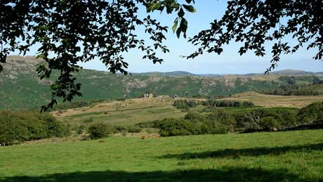
Picture 1 - is the view from the garden at Long Garth Farm, near
Broughton-in-Furness, our holiday cottage for the week. With
views like that from your garden, you would be quite happy to
sit and admire the scenery but .... we had photography and
exploration as our missions, so we could not linger too long!
The building in the middle distance is the ruins of Frith Hall,
built in the 1600s. It was once used as a lodge for deer hunting
in the Ulpha woods and was later converted to a hostelry for
pack horse teams and drivers. Footpaths (often difficult to
locate and traverse) lead to the ruins, with views over the
Duddon valley.
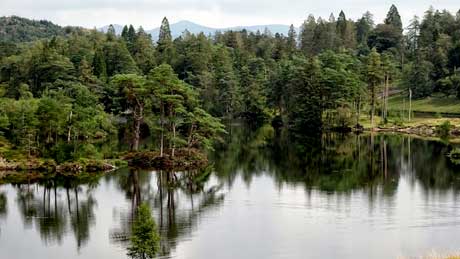
Picture 2 -Tarn Hows is one of the most visited
spots in Lakeland and the car park soon gets full at high
season. Car parking is free for National Trust members. The
approach roads are narrow but the final views make it worth the
effort, with stunning vistas towards Wetherlam, the Helvellyn
range and the Langdale Pikes. The tarn is partly artificial,
being three tarns joined together in the 19th Century. Most of
the trees surrounding Tarn Hows are conifers. There is a level,
1.5 mile path round the tarn that is suitable for wheelchairs.
Beatrix Potter bought the land in 1929. She sold the half
containing Tarn Hows to the National Trust and bequeathed the
rest of the estate to the Trust in her will.
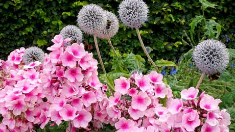
Picture 3 - Sizergh is a Grade I listed
building, 6 miles south of Kendal. It has been the home of the
Strickland family for more than 750 years and it remains their
home today. Catherine Parr, the sixth wife of Henry VIII and a
relative of the Stricklands, is thought to have lived here after
her first husband died in 1533. In 2016 the Sizergh estate was
included in the newly extended Lake District National Park. The
property is in the care of the National Trust. The large gardens
contain the National Trust’s largest limestone rock garden. The
garden has elusive hawfinches (best spotted between March and
April) and its own beehives. When we visited there were bees
everywhere, with five bees visible on the allium plants in the
photograph and scores more bees in the kitchen garden.
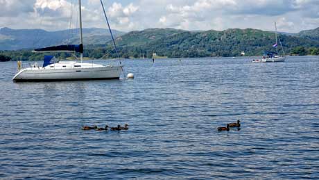
Picture 4 - The Brockhole Lake District
Visitor Centre is situated on the shore of Windermere. At 10.5
miles long, Windermere is England's largest lake. Brockhole is
located between the towns of Bowness-on-Windermere and
Ambleside. Entrance to the Centre and its grounds is free of
charge, although a charge is made for car parking. The site
focuses on a number of adventure playgrounds, including boat
hire, kayak tours, tree top nets and ropeways, laser clay pigeon
shooting, archery and bike hire. For those who prefer more
tranquil and much less expensive activities, there are walks in
the woodland areas that extend to the shore of Windermere (see
picture) and the formal gardens of Brockhole house, built in
1897 are free to visit. The Lake District National Park
Authority purchased the property and grounds in 1966, and in
1969 it was opened as the UK's first National Park Visitor
Centre.
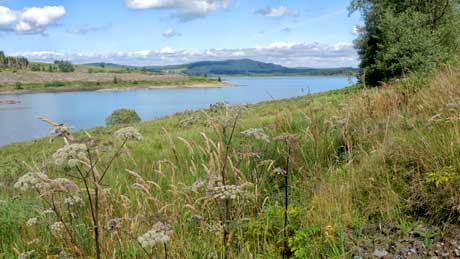
Dumfries and Galloway is located in south west Scotland. The area includes the Galloway Forest that extends to three hundred square miles and is famed for mountain biking, walking trails and its abundance of wildlife. There is little light pollution, which led to the country's first Dark Skies Park. Dumfries and Galloway is the mildest region in Scotland, is warmed by the Gulf Stream and has miles of quiet sandy beaches and coastal cliffs.
Picture 1 - Clatteringshaws Loch is located
on the eastern fringes of the Galloway Forest Park. It was
created in the 1930s for the Galloway hydro-electric scheme but
now blends seamlessly into the natural landscape. The
Clatteringshaw visitor centre is a haven for waterbirds in
summer. On a clear day you can see Merrick, the highest hill in
the Southern Uplands. The loch is also one of the best places to
enjoy the night sky as the visitor centre overlooks the darkest
part of the Forest Park.
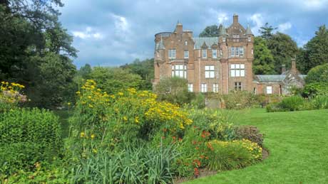
Picture 2 - Threave Garden and Estate is
located near Castle Douglas and is managed by the National Trust
for Scotland. The garden covers 64 acres and is a part of the
1,500 acres Threave Estate that was originally developed by
William Gordon, who bought the estate in 1867. The gardens
include a walled garden, a rock garden, several ponds and water
features. The wider estate is managed as a nature reserve, is
home to bats and ospreys and includes part of the Loch Ken and
River Dee Marshes Special Protection Area.
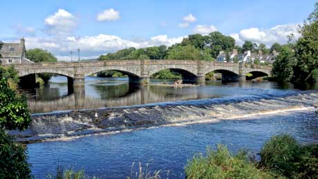
Picture 3 - Newton Stewart, located on the Rive
Cree is sometimes referred to as the 'Gateway to the Galloway
Hills'. The town was founded in the mid 17th century by William
Stewart, who was the fourth and youngest son of the 2nd Earl of
Galloway. Newton Stewart (New Town of Stewart) was granted burgh
status by a charter from King Charles II, allowing a weekly
market and two annual fairs to be held.
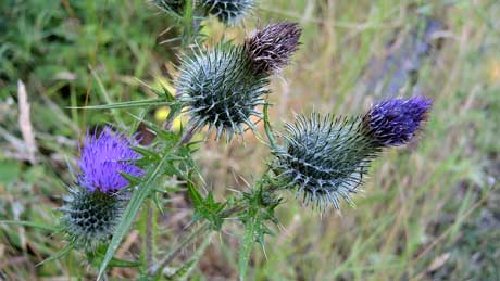
Picture 4 - The thistle is Scotland's
national flower. Legend has it that a sleeping party of Scots
warriors were saved from ambush by an invading Norse army when
one of the enemies trod on the spiky plant. His cry roused the
slumbering warriors who duly vanquished the invader and adopted
the thistle as their national symbol. The thistle has been an
important symbol of Scottish heraldry for over 500 years. The
Most Ancient and Most Noble Order of the Thistle is an order of
chivalry which is bestowed to those who have made an outstanding
contribution to the life of Scotland and the greater United
Kingdom. James II (James VII of Scotland) established the Order
with a statutory foundation under new rules in 1687. The order
is second only to the Most Noble Order of the Garter.
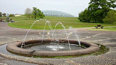
Picture 1 - The National Botanic Garden of
Wales is located at Llanarthney in the River Tywi valley,
Carmarthenshire. The garden houses the world’s largest
single-span glasshouse (far distance) at 110 m (360 ft) long by
60 m (200 ft) wide, also the British Bird of Prey Centre, a
tropical Butterfly House, play areas and a national nature
reserve. The garden is both a visitor attraction and a centre
for botanical research and conservation.
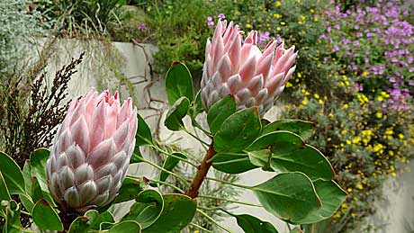
Picture 2 - Protea plants in the Great
Glasshouse, that was designed by Foster and Partners. The roof
contains 785 panes of glass and houses plants from several
Mediterranean climate regions, also Chile, Western Australia,
South Africa, California and the Canary Islands.
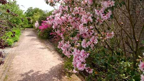
Picture 3 - Herbaceous borders including a
rhododendron - variety Pink Gin.
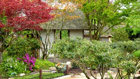
Picture 4 - This Japanese garden is called
‘Sui ou tei’, which refers to the national flowers of Japan and
Wales, the cherry blossom and the daffodil. Constructed in 2001,
the garden started life as a Show Garden at the RHS Chelsea
Flower Show, winning a Gold medal and coveted ‘Best in Show’ for
its designer, Professor Masao Fukuhara. In 2017 The Japanese
Garden Society (JGS) led a restoration programme, part-funded by
the Japanese government. Repairs to the building, wall, paths
and bamboo fence, extensive pruning and replanting were
completed in spring, 2019.
History - The Middleton family from Oswestry
built a mansion here in the early 17th century and in 1789 Sir
William Paxton bought the estate and created a water park.
Paxton was a Scottish-born sailor, a businessman, the Welsh
Member of Parliament for Carmarthen and was instrumental in
developing Tenby as a seaside resort. By the time of Paxton's
death in 1824, Middleton Hall estate covered some 2,650 acres.
Under the guidance of the Welsh Historic Gardens Trust, an
application was made to the Millennium Commission to fund
Britain’s first national botanic garden for 200 years. The
Garden was opened to the public for the first time on 24th May
2000, and was officially opened on 21st July 2000 by Prince
Charles, the Prince of Wales.
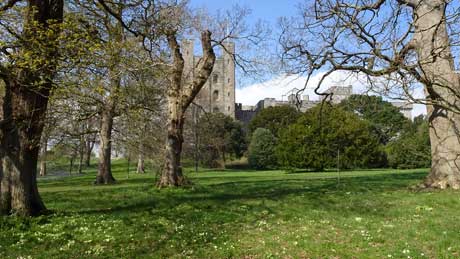
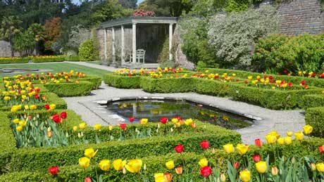
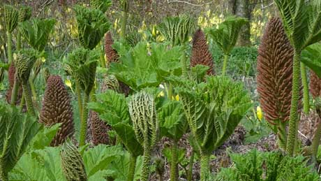
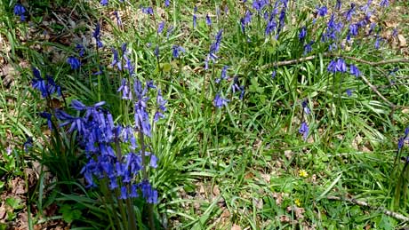
Penrhyn Castle, in Gwynedd, is a National Trust property in the design of a 19th-century neo-Norman castle. The estate has a very dark history of exploitation as the family had strong connections with the transatlantic slave trade. The 1st Baron Penrhyn (Richard Pennant) made his fortune from slavery in Jamaica and from the local Welsh slate quarries. Pennant owned one of the greatest estates on the island of Jamaica, with six sugar plantations. As the estate grew, so did the numbers of enslaved people. Unsurprisingly, Pennant was a staunch anti-abolitionist (!) and he sat in the House of Commons between 1761 and 1790. By 1805 he owned nearly 1000 enslaved people across his plantations. Penrhyn was originally a medieval fortified manor house, founded by Ednyfed Fychan but the present building was created between about 1822 and 1837. In 1951 the castle and 40,000 acres of land were accepted by the treasury in lieu of death duties. Penrhyn has a formal walled garden, extensive informal gardens, an adventure playground, picnic areas, a narrow gauge railway museum, woodland walks and one of the finest art collections in Wales. Picture 1 - The approach driveway to Penrhyn Castle with its wild primroses (primula vulgaris). The name derives from the Latin prima rosa meaning 'first rose' of the year, despite not being a member of the rose family. The primrose is my favourite flower and was also the favourite of former Prime Minister Benjamin Disraeli. Primrose Day is on 19th April, the anniversary of Disraeli's death.| Picture 2 - Tulips on the top terrace of the Victorian walled garden. Tulips are the third most popular flowers world-wide, next only to the rose and chrysanthemum. | Picture 3 - Gunnera plants, commonly thought of as 'giant rhubarb' in the jungle like, lower bog garden, which is part of Penrhyn's walled garden | Picture 4 - Native bluebells : The UK's native bluebells are generally deep violet-blue, have a strong, sweet scent, with the drooping flowers mostly on one side of the stem. More than a quarter of the world's bluebells are found in the UK. Sadly, our native bluebell is losing ground to the more vigorous Spanish bluebell, which was introduced by the Victorians.
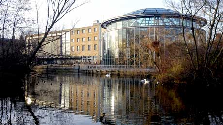
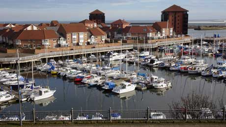
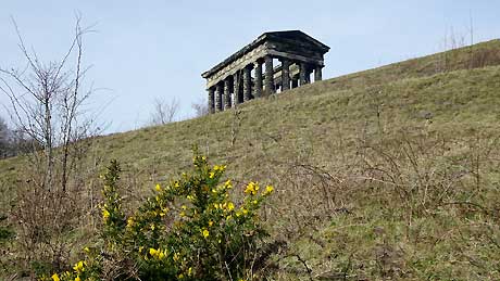
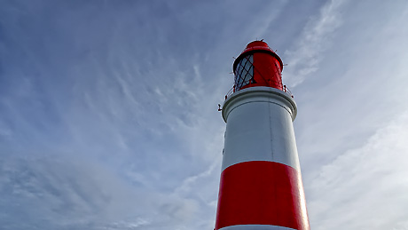
Picture 1 - Sunderland Museum and Winter Gardens contain over 2,000 flowers and plants, the only known British example of a gliding reptile and the first Nissan car to be made in Sunderland. In 2003 the Museum was recognised as the most attended outside London. The artist L.S. Lowry 'discovered' Sunderland in 1960, after which it became his second home. Sunderland Museum has 6 of Lowry's works and 30 on long-term loan, a collection surpassed only by Salford and Manchester. | Picture 2 -Roker is a tourist resort and affluent area of Sunderland and is administered as part of the City of Sunderland. The marina at Roker is known as Sunderland Marina, is situated on the north east coast at the mouth of the River Wear and offers sailors immediate access to the open sea at all states of tide. The Marina consists of 132 pontoon moorings and 95 fore and aft moorings. In addition to Seaburn seafront, the coast at Roker seafront plays host to Sunderland International Airshow, the biggest free airshow in Europe, which takes place each year, usually over the last weekend in July. | Picture 3 - The Penshaw Monument (officially The Earl of Durham's Monument) is at Houghton le Spring, Sunderland. It is dedicated to John George Lambton (1792–1840) who was the 1st Earl of Durham and the first Governor of the Province of Canada. The foundation stone was laid on 28th August 1844. The monument was acquired by the National Trust as a gift from the 5th Earl of Durham in 1939 and features on the club badge of Sunderland Football Club.| Picture 4 - Souter Lighthouse, opened in 1871, is in the village of Marsden - South Shields. Souter was the first lighthouse in the world to be actually designed and built specifically to use alternating electric current, the most advanced lighthouse technology of its day. The lighthouse is located on Lizard Point, but takes its name from Souter Point, which is a mile to the south. The name was retained in order to avoid confusion with the then recently-built Lizard Lighthouse in Cornwall. Souter was never automated and was decommissioned in 1988. It retains much in its original equipment, is now owned by the National Trust and is open to the public.
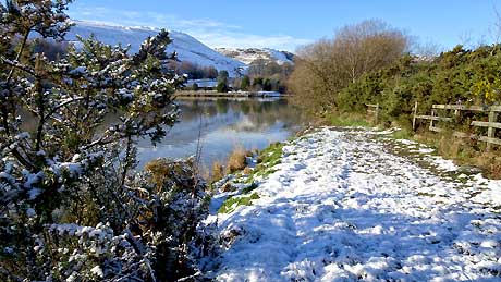
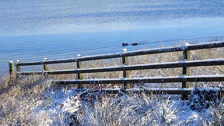
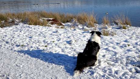
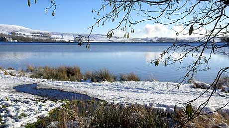
The four photographs were taken at Cowm Reservoir, Whitworth
(our home town) in the South Pennines, Rossendale. Cowm
reservoir was heavily polluted in the early 1970s from a tyre
fire, which effectively terminated its use as a supply of
drinking water for the area and it is now used as a water ski
academy. There is a well surfaced, easy walk round the
reservoir. If you prefer a more strenuous walk, a bridle path at
the far end of the reservoir takes you over the hills (with
extensive views of the surrounding area) and leads to Hallfold.
From here you can extend your walk to Healey Dell Nature
Reserve.
Mountain bike magazines class the South Pennines as having some
of the best riding in the country. Rossendale also has more
public footpaths within its boundary than any other town or
borough in the country. For energetic walkers the 47 mile long
Rossendale Way crosses over the summit of Whitworth's Brown
Wardle Hill. Healey Dell Nature Reserve is at the southern edge
of Whitworth. The former single track railway that runs through
the valley is long gone but in its place is an easy going walk
through the Reserve. Watergrove Reservoir and Hollingworth Lake
Country Park are both close by and are developing as wildlife
refuges.
In November 2018 discussions took place as to whether the South Pennines should become England’s first regional park. A regional park is "an area of land preserved on account of its natural beauty, historic interest, recreational use or other reason, and under the administration of a form of local government." The South Pennines were put forward as a potential national park as long ago as the 1940s, but were turned down because with its then still-working mills it was considered too industrial compared with places such as the Lake District. The South Pennines is now the only extensive English uplands not to have its beauty and character formally recognised.
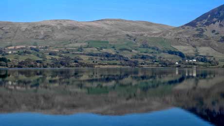
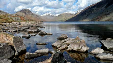
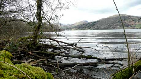
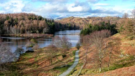
Picture 1 - Ennerdale Water is the most westerly of the lakes, and is very remote. Even in peak season, Ennerdale is a place to escape from the crowds, as it is the only lake that does not have a road running alongside it. Much of the shoreline and some of the surrounding fells are owned by the National Trust. | Picture 2 - Wastwater in Wasdale, is one of my favourite locations. On 9th September 2007 Wast Water was voted the best view in the UK in the ITV programme 'Britain's Favourite View', beating 15 other nominated locations. Wasdale Head is the starting point for climbers attempting to climb Great Gable, Scafell Pike, Pillar, Kirkfell, Lingmell and other mountains in the area. | Picture 3 - Windermere, from Wray Castle. At ten and a half miles long, Windermere is England's largest lake. Wray Castle is a Victorian neo-gothic building whose house and grounds have belonged to the National Trust since 1929 | Picture 4 - Tarn Hows is one of the most visited spots in Lakeland and can become overcrowded in summer. Lovely and quiet though out of season, on a day such as when this photograph was taken! The tarn is partly artificial, being three tarns joined together in the 19th Century. The views of the Helvellyn range and the Langdale Pikes are outstanding. There is a 1.5 mile level, easy walking path round the tarn.
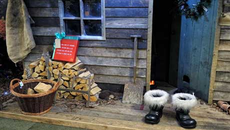
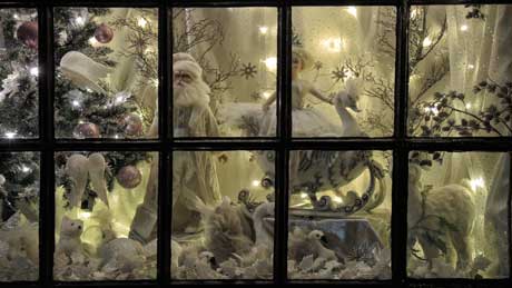
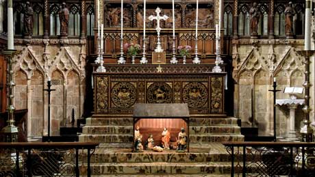
Picture 1 - Waiting for Father Christmas at the Gordon Rigg Garden Centre in Walsden, Todmorden - West Yorkshire. Gordon Rigg's is one of the largest Garden Centres in the North West of England. It was voted best Garden Centre in the North and 2nd best in the UK by Which? Magazine! | Picture 2 - The apothecary window display at Haworth, in West Yorkshire. Haworth's main claim to fame is its association with the literary Brontë sisters - Anne, Charlotte and Emily. The apothecary is where their brother Branwell, who was a creative writer and painter, bought his opium. Branwell was an alcoholic and an opium addict, addictions that ultimately led to his death at the age of 31. | Picture 3 - The Nativity at Selby Abbey in North Yorkshire. Selby is one of the relatively few surviving abbey churches of the medieval period and is one of the biggest. It is dedicated to St. Mary the Virgin and St. Germain. St. Germain was the bishop of Paris and a saint of the Eastern Orthodox Church and the Catholic Church. According to an early biography, he was known as Germain d'Autun - the 'Father of the Poor'. | Picture 4 - Howden Minster is also known as the Minster Church of St. Peter and St. Paul and is located in the East Riding of Yorkshire. There has been a church at Howden since Anglo-Saxon times. The Church of England Minster and Chapter House are Grade I listed (1966). The Great West Window (see picture) contains two scenes of 19th century glass by the Belgian glazier, Jean-Baptiste Capronnier and may have been inspired by windows in Cologne cathedral.
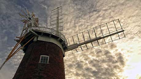
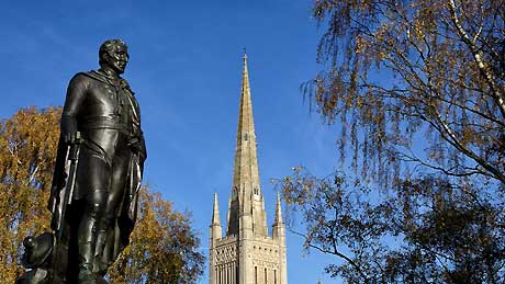
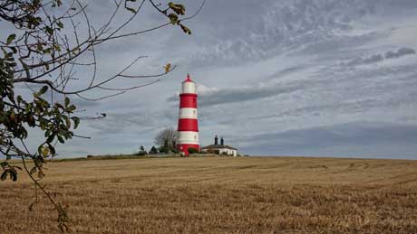
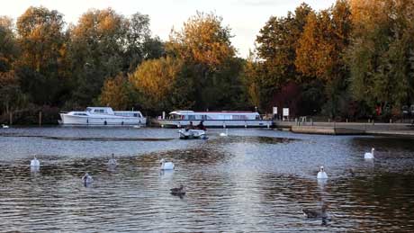
Picture 1 - Horsey Windpump was used for land drainage. It is a Grade II listed building, located in the village of Horsey, near Great Yarmouth in Norfolk. The present structure was built in 1912 on the foundations of the 18th-century Horsey Black Mill. It was acquired by the National Trust in 1948 from the Buxton Family. | Picture 2 - The statue of Arthur Wellesley, 1st Duke of Wellington, outside Norwich Cathedral in Norfolk. Wellington was the British supreme commander during the Napoleonic Wars and became famous thanks to his victory in the Battle of Waterloo. Norwich Cathedral has the second largest cloisters in England, only exceeded by those at Salisbury Cathedral. The cathedral spire is the second-tallest in England, again, exceeded by Salisbury. | Picture 3 - Happisburgh Lighthouse, on the North Norfolk coast is the only independently operated lighthouse in Great Britain (after receiving the Royal Assent as a Local Light Authority on 25th April 1990). It is also the oldest working lighthouse in East Anglia. Happisburgh Lighthouse was constructed in 1790, and is 85ft (26m) high. The lighthouse was electrified in 1947 and has a range of 14 nautical miles. | Picture 4 - The busy village of Wroxham is located within the Norfolk Broads. It's often called "the Capital of the Broads" and Wroxham Bridge is considered to be the second most difficult on the Broads to navigate (after Potter Heigham). A pilot station is located on the Hoveton side of the river, ready to assist boaters, for a fee.

